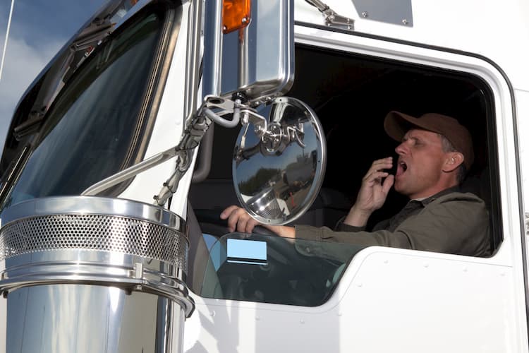
Imagine you’re a truck driver whose shift is coming to an end late at night. The roads are dark and you’re tired. You’re struggling to keep your eyes focused on the road and you can feel yourself drifting in and out. Suddenly, a loud beeping noise pierces through the truck cabin. You’re quickly jarred awake and refocus on the road.
The FleetCam® AI camera detected your eyelids closing, and the Lane Departure sensors noticed you were drifting towards the shoulder of the road. The system sent out an audible alert and got you back on track until you were able to pull over safely.
Now imagine you’re driving a large truck through a tunnel during rush hour. Traffic is moving along, but there are a lot of cars around you. You’re paying attention to a vehicle that’s merging nearby and don’t notice the driver ahead of you has suddenly slammed on the brakes. Your FleetCam® system does pick up on it though, and the in-cab alert system starts going off to alert you to the danger. It gives you enough time to hit the brakes and prevent a collision.
These examples are some of the many reasons why so many fleets are installing FleetCam® Enterprise AI into their vehicles. These kinds of things are picked up by FleetCam® AI cameras and sensors regularly; giving the driver real-time alerts when problems arise. The technology is helping save lives on the road.
However, that technology has to be precise and reliable in order to do that; no matter what kind of conditions the driver is traveling through. In order to accomplish this, the AI needs to have an accurate and frequent speed reading. FleetCam® utilizes GPS, the vehicle’s ECU, and now dead reckoning technology to make it nearly impossible to kill.
Dead reckoning is a navigational process that helps vehicles, ships, and planes calculate their current locations and ground tracks. The mathematical equation uses velocity and directional information to estimate where they currently are. The formula also accurately estimates where they will end up if they continue at their current speed and direction.

Dead reckoning was used by ship navigators for centuries, including Columbus and most other mariners during the Age of Exploration. It was necessary when the navigator was unable to use a land mass or the stars to determine the ship’s location out at sea.
It was the first navigational method that required a daily log. Navigators would start at their last known location on their sea chart. Then, using the ship’s compass heading, speed, and time spent on each heading at each speed, a navigator would calculate the route and distance the ship covered at sea to determine where they were on the map.
Over time, this process has gone from a manual computation to a computer automation that generally serves as a backup navigational tool for more advanced systems. It is still used by ships, airplanes and some vehicle navigation systems to provide an alternative tracking method when a standard GPS signal is interrupted. For instance, dead reckoning is the default mode in the event of a failure in some Flight Management Systems.

While dead reckoning is not the go-to tracking method anymore; this basic navigational method is still sometimes used by low speed, small airplane pilots. The process helps them estimate their current track, groundspeed and position based on earlier known positions. They also have to consider wind speed and an airplane’s weight when making calculations.
Traditional telematics devices and telematics service providers generally use standard GPS modules that do a good job of tracking a vehicle – as long as there is a clear line of sight from the satellites to the device; without any tall structures or natural elements blocking the connection.
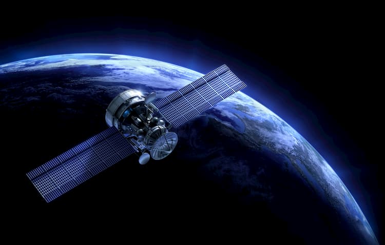
Millions of GPS users across the world depend on Global Navigation Satellite System signals to do things like determine their location, track vehicles, or map out areas. The current GNSS GPS constellation is comprised of 31 active satellites that revolve around the Earth in six different orbits; making sure GPS servers and devices receive signals from at least five satellites at all times. A GPS device needs to connect to at least four satellite signals in order to calibrate its exact location; otherwise it won’t be able to get an accurate reading.
The downside of these signals coming from space is things can get in the way. These signals have to travel quite a long way before they reach a GPS device. They pass through the vacuum of space, and then the different layers of Earth’s atmosphere. Then they must compete with dense clouds, dust particles, mountains, and man-made objects like airplanes.

The most common factor that interferes with a GPS signal is what’s called the “Urban Canyon.” It refers to areas that are filled with high rise buildings that don’t allow the signals to get through. They can completely block the signal or alter the signal’s path, so it never reaches the GPS device. When the signals do manage to get through, they’re often too weak for the GPS device to interpret them.
In urban canyons, GPS signals have to contend with:
Without that information, systems relying on real-time speed and location readings can be left with holes in their data. That information gap can cause those systems to become ineffective until they regain a reliable signal.
A weak connection is a problem when you are counting on standard GPS to keep your advanced driver assistance systems (ADAS) and driver monitoring systems (DMS) working; no matter what conditions a vehicle is traveling through. The reason being; you need to be able to monitor a vehicle’s speed and location in order for the AI-supported ADAS and DMS systems to accurately detect what’s happening on the road.

Dead reckoning is an integral part of the FleetCam® collision prevention system for that reason. It helps the AI features determine where a vehicle will end up if it continues to travel at its current speed and direction. That calculation is invaluable when using it to bolster the FleetCam® collision prevention system’s readings. It helps AI determine if the driver is on track to leave a lane or crash into a stopped vehicle.
It’s crucial that you know exactly where company vehicles are located, which dead reckoning technology helps you determine. With an accurate, real-time location, you can find the closest driver for last-minute pickups, see who needs to be detoured in the event of a road closure, and see how long it will take to get a delivery to the customer.
Although dead reckoning technology can become less accurate the longer the GPS system is out of contact with satellites, it automatically recalibrates as soon as it reconnects with the signal. It uses the new coordinate information to adjust its readings and update the vehicle’s location information.

FleetCam® is the most advanced video telematics system on the market and is designed to be a reliable, rugged system that works no matter where you are. We use dead reckoning technology to keep track of a vehicle’s location when the GPS signal is weak or blocked and to ensure that our ADAS and DMS systems are working properly; regardless of the conditions your vehicles are traveling through.
FleetCam® is one of the only telematics systems on the market that utilizes dead reckoning technology to improve its ADAS and vehicle tracking systems.
Other ADAS providers generally use speed tracked by the Engine Control Unit (ECU) to help determine a vehicle’s location, but problems can arise when relying solely on this. Their location tracking systems need to utilize something that may be connected to a number of different devices, like lifts, sirens, ELD units, and other telematics devices. That much traffic can interfere with the signal; making it harder to get the information from the ECU and making the location tracking system less reliable.
Not all vehicles’ ECUs track speed either; which is a big problem when your telematics system requires that information to work. It’s also more time-consuming and expensive to connect a telematics system to a vehicle’s ECU, especially if you move FleetCam® to another vehicle at some point. On the other hand, it’s easy to install a GPS with dead reckoning.
FleetCam® is one of the only telematics systems on the market that utilizes dead reckoning technology to improve its ADAS and vehicle tracking systems.

ADAS and DMS help build better driving habits and alert drivers to danger before it’s too late. Dead reckoning ensures that these features have the information they need to be accurate and reliable; keeping your drivers safe, as well as your company’s reputation.
FleetCam® utilizes the most advanced technology available to deliver the best fleet video telematics and collision prevention system around. Get in touch with us today to get FleetCam® with AI and dead reckoning technology working for you and your drivers.
Recent Posts
Categories
Stay in Touch


Ready to make fleet management more manageable?


